|


|
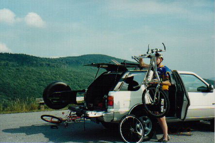
After nine hours in the truck we
were ready to stretch out and get our knobbies dirty.
Jeff, the bartender at the ERTC Restaurant, suggested the
Tea Creek Mountain loop to "get a taste" of
what all the WV hype is about. We parked the Rodeo at
Little Laurel Overlook on Scenic Highway 150 just across
from the trailhead. The view was incredible. We could
only imagine the riding that lay ahead. The loop begins
with a short climb on a rocky, rooted, single-track that
literally hugs the mountain. Put a wheel wrong and you'll
fall far. The trail meanders for a couple of miles before
reaching a huge boulder field that is impossible to ride.
However, you are rewarded after 100 yards of hike-a-bike
with what has to be one of the sweetest single-track
downhills this side of the Mississippi. It starts steep
and gets even steeper after crossing the North Face
Trail. We like to ride fast but heed this warning: keep
your weight back and two fingers on each brake lever.
You'll fly. Dips, bumps, and even banked turns are all
part of the action. Assuming you reset your odometer at
the trailhead, it will read some six miles when you
bottom-out at the Tea Creek Campground. Then it's a two
to three mile grind up the scenic highway to the overlook
and your vehicle. Jeff's recommendation was right on, and
that first "taste" of WV only made us hungry
for more.
Saturday
morning we awoke to overcast skies and typical
mid-Atlantic summer humidity. After downing a healthy
portion of home-cooked scrambled eggs and pancakes in the
dining room the skies opened up. Luckily Gil, the owner
of ERTC, was on hand to provide some expertise on where
to ride given the soggy conditions: "If I were
riding today I'd go over to Marlinton. The report is it's
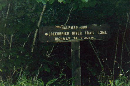
not raining over there." Marlinton is the Pocahontas
County seat and also home to the Marlinton Ranger
Station, starting point for a ten-mile loop of Marlin
Mountain. The first three miles are a middle chainring climb on a Forest Service fire road. Before topping-out
at a grassy intersection, the road narrows and bends
towards the sky at a 20% grade for 100 yards. The descent
is gradual at first, rolling fast through tall grass on
one side of the double-track. Next, the trail steepens,
becomes more rocky and on this particular day, like a
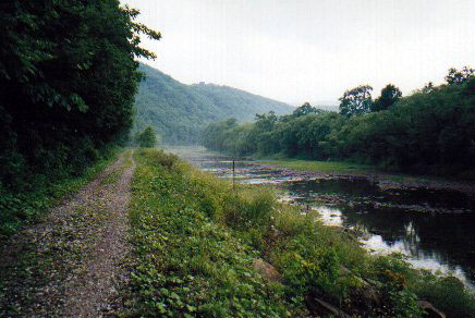
rainforest. After about two miles the trail bottoms out
at the Greenbrier River Trail, an abandoned rail bed that
follows the Greenbrier River. We found a great place on
the river to ditch our shoes and socks. After cooling off
we high-tailed it into town for some grub. Back at the
truck, we planned our afternoon ride.
|